Success of past rounds fuel call for a new round of Research Forward funding
The University of Wisconsin helped invent weather satellites leading to research past and present in service of the Wisconsin Idea – to conduct research that educates and serves society.
In the late 1950s, UW professors Vernor Suomi, a meteorologist, and Robert Parent, an engineer, led the design and fabrication of an instrument to measure Earth’s radiation balance. Launched in 1959 aboard the Explorer VII satellite, the instrument became the basis of history’s first successful meteorological experiment from space.
Suomi and Parent went on in the 1960s to invent the spin-scan cloud camera, which launched onboard ATS-I, the first geostationary satellite.
The innovation changed meteorology, giving scientists a time lapse view into atmospheric conditions. Suomi – the first director of the Space Science and Engineering Center – also collaborated with NASA to launch the first spin-scan cloud camera into Earth’s orbit. Suomi’s camera enabled weather satellites to gather continuous images of weather as it happened and earned him the title of the father of satellite meteorology.
Since Suomi, weather satellites – and their use in data collection at UW – have continued to evolve. In fact, weather satellites can now estimate photosynthesis in real-time, thanks to Research Forward-funded research being conducted at UW–Madison.
Research Forward is an Office of the Vice Chancellor for Research and Graduate Education (OVCRGE) initiative that fosters innovative and collaborative projects. The OVCRGE recently announced a call for a new round of the Research Forward proposals and the initiative is supported by the Wisconsin Alumni Research Foundation (WARF). Research Forward provides funding for 1–2 years, depending on the needs and scope of the project. Abstracts and cover sheets are due on November 17, 2023, and full proposals are due Jan. 24, 2024.
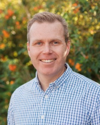
 A Research Forward project led by Paul Stoy with colleagues across campus, “Measuring Land Surface Carbon Uptake in Real Time Using Geostationary Satellites,” is using remote technologies to study surface-atmosphere exchange of greenhouse gases, water and heat. Remote sensing technologies are helping Stoy, associate professor of Biological Systems Engineering and affiliate with the Nelson Institute of Environmental Studies, better understand the role of land use, land management and conservation in the climate system.
Stoy’s project website provides open-source data and updates to the project.
“All of our code is open access and uses open-access data, with recent outputs and results described online,” he explains.
“Photosynthesis is sensitive to extreme events and climate change, and we need to understand it to effectively manage ecosystems in Wisconsin and elsewhere,” notes Stoy, who grew up in Wisconsin and received his undergraduate degree from the UW. “Satellites have long provided defensible estimates of photosynthesis on weekly to annual time scales, but ecosystem disturbances can happen much faster, and better choices can be made with information that arrives instantaneously rather than retrospectively.”
Stoy’s team is working to estimate carbon fluxes in real time using geostationary ‘weather’ satellites, especially GOES-R (the Geostationary Operational Environmental Satellite – R Series).
Research Forward projects, such as Stoy’s, not only have the potential to open up pathbreaking new research avenues or fundamentally transform a field of study. They are being more fully developed, allowing them to be more competitive for external funding.
Stoy’s project data and results are being used to round out competitive federal grant proposals with the goal to build a center of excellence in real-time carbon cycle monitoring at UW–Madison.
Stoy and his UW–Madison co-PIs were recently successful in obtaining USDA FY24 Hatch Formula funding for their project, “Improving crop yield estimates by adding geostationary satellite measurements to machine learning techniques.” The purpose of Hatch Act funding is to conduct agricultural research programs at State Agricultural Experiment Stations.
Stoy also has submitted a proposal to NASA entitled, “Quantifying rapid changes to the coupled terrestrial carbon and water cycles using operational geostationary satellite systems” with forthcoming proposals to other federal agencies in planning stages.
The project also has created training opportunities for undergraduate and graduate students, invited seminars, and connections with the global research community. Stoy is co-coordinating a special issue of the journal Remote Sensing of Environment on geostationary remote sensing of the carbon cycle with international colleagues and has been invited to give talks at the University of Minnesota, Nanjing University of Information Science and Technology, and the AsiaFlux conference in Kuching, Sarawak, Malaysia.
“Research Forward was instrumental in growing my research endeavors to the point that it now attracts national and international attention,” Stoy says. “Research Forward has helped us pay tribute to the strong history of remote sensing and satellite imagery born and nurtured at UW–Madison over 57 years. It’s an honor to be a part of that tradition and to be bringing a new generation of researchers into this exciting field.”
### By Natasha Kassulke, natasha.kassulke@wisc.edu
